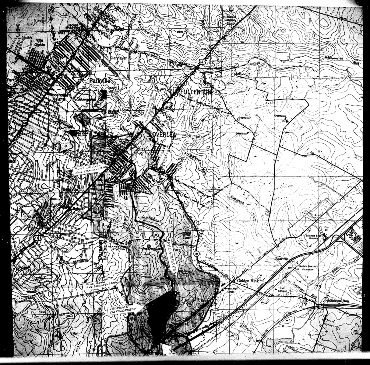
Two U.S. Geological Survey topographic maps were submitted to show the geographic context of the proposed development. They show the 115-acre Red House Run tract outlined as "Proposed Development," and annotate the surrounding built-up residential areas (average density 11 units/acre) versus the proposed tract (38 acres at 38 units/acre). Visible landmarks include Parkville, Fullerton, Overlea, Golden Ring, Rosedale, Chesaco Church, Back River, and the Red House Run creek itself.
Document Contents
Transcribed from the original scanned documents. Some text may be approximate due to document age and handwriting.
Map Annotations
Visible labels and annotations on the two topographic maps:
Neighborhoods shown: Parkville, Glenhaven, Fullerton, Overlea, Woodhouse Heights, Belair, Belona, Rosedale, Golden Ring, Steindners Run, Essex, Chesaco Park, Armistead Gardens, Back River, Gray Manor
Key annotations:
- "RED HOUSE RUN" (creek, prominently labeled)
- "PROPOSED DEVELOPMENT" (the 115-acre Hooper Co. tract, shown as solid black)
- "BUILT UP AREA — AVG. DENSITY: 11/AC"
- "TOTAL AREA: 38AC — AVG. DENSITY: 38/AC"
- "Baltimore Transformation Station"
- "Red House Run Dump Sta."
- "Marietta Concrete Corporation"
- "Zion Church"
- "Norwood High School"
- "Essex School"
- "St. Peters Church"
- "Baltimore City Back River Sewage Works"
- "Greenmarsh Point"
Railroad lines: Pennsylvania Railroad; B&O Railroad (BALTO.-BALT. BASE)
Roads: Pulaski Highway, Philadelphia Road, Eastern Avenue, North Point Road